Geography

About the Department

The Department of Geography is guided by the objectives of the Federal University of Technology, Minna, which is committed to producing skilled and highly qualified manpower for both national development and the global community. In pursuit of this mission, the Department offers undergraduate and postgraduate programmes designed to produce applied geographers equipped to address the complex challenges arising from resource depletion in an increasingly urbanised and interconnected world. To this end, the Department provides degree specialisations in Applied Remote Sensing and Meteorology.

Central to the Department’s academic philosophy is the application of geographical methods to the systematic study of the interrelationships among the physical environment, the economy, and the structure of society. This is examined within the context of dynamic and evolving conditions across spatial scales, from the local to the global with the aim of generating knowledge and solutions relevant to contemporary environmental and socio-economic challenges.

History of the Department

The Department of Geography was established in 1983 as one of the pioneer departments of the Federal University of Technology, Minna. In 1985, three degree specialisation options were introduced: Meteorology (MET), Remote Sensing Applications (REM), and Urban and Regional Planning (URP). Following the graduation of two cohorts of students, the URP option was elevated to the status of a fully-fledged department within the School of Environmental Technology in 1990. Notably, the Department of Urban and Regional Planning now counts among its academic staff several faculty members who obtained their postgraduate degrees at both Masters and Doctoral levels from this Department.

Postgraduate programmes in Meteorology and Remote Sensing Applications were introduced in 1992, and a Postgraduate Diploma as well as a Master of Technology in Environmental Management were subsequently introduced in 2005. The Department has been producing doctoral graduates since 1996. Over the decades, the academic staff strength has grown steadily, from five members in 1986 to seventeen full-time departmental staff members at present.

The first pioneer Head of Department (HOD) was Prof. G. N. Nsofor, who served from 1983 to 1986. He was succeeded by Prof. A. S. Abubakar (2009–2012), Prof. A. A. Okhimamhe (2012–2014), Prof. Aishetu Abdulkadir (2014–2019), Prof. Mairo Muhammed (2019–2023), and the late Prof. Suleiman Y. Mohammed (2023–2024). The department is currently headed by Prof. Yahaya Tayo Iyanda, who has been serving since 2024 to date.

Vision

The vision is to become a reputable department that provides high quality teaching and research using state-of-the-art technologies including Information and Communication Technology (ICT) at higher level on the Science of Geography, Meteorology, Remote Sensing Application and Environmental Management.

Mission

The mission is to provide world class training on the use of Geography, Meteorology, Remote Sensing Application and Environmental Management, in order to solve environmental problems, as well as uplift the University’s image both nationally and internationally, as a Centre of Excellence in training of qualified personnel at both undergraduate and postgraduate levels

Geography

Geography is the study of places and the relationships between people and their environments. Geographers explore both the physical properties of Earth’s surface and the human societies spread across it.

Applied Meteorology

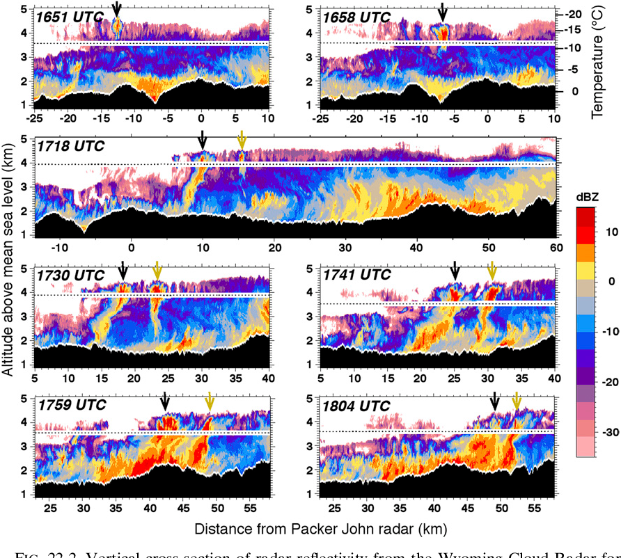
A field of study where weather data, analyses, and forecasts are put to practical use.

Environmental Management

Environmental management is a systematic approach to finding practical ways for saving water, energy, and materials, and reducing negative environmental impacts.

Applied Remote Sensing

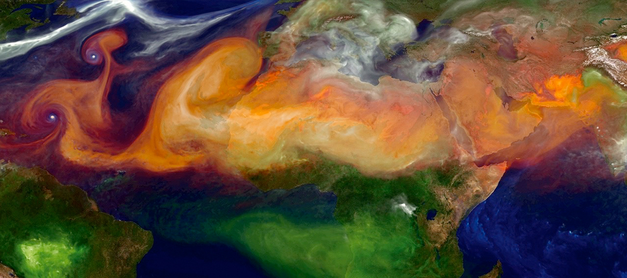
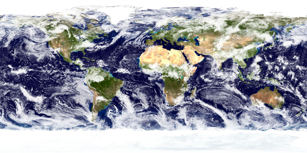
Remote sensing is the process of detecting and monitoring the physical characteristics of an area by measuring its reflected and emitted radiation at a distance (typically from satellite or aircraft). 

Programmes Offered

  1. i) Undergraduate: Bachelor of Technology in Geography (B.Tech Geography)


(ii) Postgraduate: Environmental Management, Geography, Remote Sensing and Meteorology

(iii) Accreditation status: Fully accredited

(iv) External linkage(s)

            (a) Collaboration with International Society for Applied Research (ISAR) to present a paper entitle; Climate Change Induced Agro-ecoclimatic Zonation (AEZ) for Resilience Rainfed Agriculture in the Savanna Ecological zones of Nigeria from 20/06/026 to 21/06/2016 at Dammam, Saudi Arabia at the International Conference on Climate Change Mitigation and Adaptation Practices (ICCCMAP-26).

            (b) Geography department collaborate with MIGRAWARE as project partner from 2019 to 2024. MIGRAWARE is a BMBF (German Ministry of Education and Research) and WASCAL (West African Service Centre on Climate Change and Adapted Landuse) funded the project aimed at developing an integrated scientific/technological framework to explore drivers, processes and sustainable responses of rural-urban and cross-border migration in West Africa.

Research Outputs

(i) Total publications (5-years window): 35

(ii) Citation count: 1108

(iii) Research areas

  • Medical and Health Geography
  • Environmental management
  • Climate science
  • Biodiversity studies
  • Land use and Land cover Analysis
  • Flood and Disaster Risk Management

(iv) International co-authorship percentage (Important for QS & THE metrics): NIL

(v) Grants, Patents, Commercialization

  • Climate Change Induced Agro-ecoclimatic Zonation (AEZ) for Resilience Rainfed Agriculture and Environmental Sustainability in Savanna Ecological Zone of Nigeria (TETF/ES/DR&DCE/NRF2021/SETI/GEO/00023/VOL.1
  • Quantitative Evaluation of the Effects of Agro-Climatic Factors on Cassava Crop (MANIHOT ESCULENTA) in Ilorin Area of Kwara State, Nigeria


(vi) Journal hosted/published by the school: NIL

(vii) Collaborations

The department is in collaboration with various academic, public agencies and research institutions inside and outside the country. They include:

  1. International Society for Applied Research (ISAR),
  2. American Society of Photogrammetry and Remote Sensing (ASPRS),
  3. WASCAL (West African Service Centre on Climate Change and Adapted Landuse),
  4. Nigeria Meteorological Agency (NIMET),
  5. National Space Reasearch and Development Agency (NASRDA),
  6. Federal Airport Authority of Nigeria (FAAN),
  7. Environmental Protection Agency,
  8. Other various Land Admistrative Agencies, and other private environmental related companies in Nigeria.

Laboratory/Facilities

(i) Equipment list

1

Desktop Computers

2

Smart Projectors

3

GPS Germine

4

Cartographic Light Table and Stools

5

Steel Measuring Tape

6

Globe Map

7

Class A Pan

8

Wet and Dry Bulb Thermometer

9

Thermograph

10

Hygrograph

11

Wind vane

12

Rain gauge

13

Automated Weather Station

14

Barograph


(ii) Laboratories/Studios/Workshops

1

Remote Sensing Lab

2

Cartographic lab

3

Meteorological Station

4

PG Lecture Room

Community Services

Members of staff of the department are actively engaged in various community and consultancy services within and outside the University. They occupy membership and leadership positions such as:

  1. National Meteorological Society of Nigeria (NIMets),
  2. Association of Nigerian Geographers (ANG),
  3. International Research and Development Initiative (research and Development Iniative),
  4. Geo-information Society of Nigeria,
  5. Institute of Disaster Management and Safety Science,
  6. International Society for Photogrametry and Remote Sensing,
  7. Old Students Associations,
  8. Religious organizations and denominations,
  9. Resource Persons to Nigerian University Commission (NUC),
  10. Resource Person for the Accreditation of Geography programmes,
  11. External Moderation of Postgraduate programmes across various Universities,
  12. Technical staff for JAMB UTME examinations.
  13. Staff are also external examiners of Bachelor and higher degrees within and outside the   
  14. Some staff have served while some are still serving members of Governing Council of      Some Universities in Nigeria.

Alumni & Industry Linkages

(i) Notable alumni achievements: NIL

(ii) Industry partners

  • Nigeria Meteorological Agency
  • West African Service Centre on Climate Change and Adapted Land use (WASCAL)
  • Federal Airport Authority of Nigeria

(iii) Internship placement partners

  • Nigeria Meteorological Agency
  • National Space Reasearch and Development Agency
  • Federal Airport Authority of Nigeria

Student Resources

(i) Timetable

DAY/TIME

9.00-10.00 AM

10.00-11.00 AM

11.00-12.00 AM

12.00-1.00 PM

1.00-2.00

2.00-3.00 PM

3.00-4.00 PM

4.00-5.00 PM

5.00-6.00 PM

MON

GRY411(GRYLT1) GRY301(GRYLT1)

GEO 203 (PLT(B))

GRY517 (GRY LT1)


GRY411(GRYLT1)

GRY301(GRYLT1)

GEO 203 (PLT(B))

GRY517 (GRY LT1)


FUTM_GEO 303(GRYLAB)

GRY515 (GRYLT1)

FUTM-GEO 213 (GRYLT2)


FUTM_GEO 303(GRYLAB)

GRY 515 (GRYLT1) FUTM-GEO 213 (GRYLT2)

BREAK

GRY 413 (PLT(B))

FUTM_GEO315 (GRYLAB)

GRY551(GRYLT2)

GRY 413 (PLT(B))

FUTM_GEO315 (GRYLAB)

GRY 551(GRYLT2)

GRY 433 (GRYLT2)

GRY 433 (GRYLT2)

TUE

FUTM_GEO 315 (GRYLT2)

GRY533(GRYLT1)


FUTM-GEO 216 (GRYLT 2)


FUTM_GEO315 (GRYLT2)

GRY533(GRYLT1)


FUTM-GEO 216 (GRYLT 2)


GRY 513(GRY LT1)

GEO 453 (GRY LT2)


GRY 513(GRY LT1)

GEO 453 (GRY LT2)

GRY113(GRYLT1)

GRY 531(GRY LT2)

GEO 304(GRY LAB) GRY 455 PLT A

GRY113(GRYLT1) GRY 531(GRY LT2)

GEO 304(GRY LAB)

GRY 455 PLT A

GRY 417 (GRY LT1)

(GRY LT2)

(GRY LAB)

GRY 417 (GRY LT1)

(GRY LT2)

(GRY LAB)

WED

GRY511 (GRY LT1)

GRY415 (GRY LT2)

GRY201 (GRYLAB)

GEO 307 (PLT(B))


GRY511 (GRYLT1)

GRY 415(GRYLT2)

GRY 201(GRYLAB)

GEO307 (PLT(B))

GRY GRYLT 1


GRY557(GRYLT2)

GRY451 (GRYLAB)

GRY GRYLT 1


GRY557(GRYLT2)

GRY451 (GRYLAB)


SPORTS  


THU


GRY 435 (GRYLT1)

GRY537(GRY LT1)

GRY313(GEL LAB)


GRY 435 (GRY LT1)

GRY 537(GRY LT1)

GRY313(GEL LAB)


GRY553(GRYLAB GRY307(GRY LT1

FUTM-GEO 215 (GRYLT1


GRY553(GRYLAB

GRY307(GRY LT1

FUTM-GEO 215 (GRYLT1


GRY535 (GRYLAB)

GRY 431 (GRY LT1)


GRY535 (GRYLAB)

GRY 431 (GRY LT1)


GRY519

(PLT(A))

GEO 307 (GRY LAB)

GRY418(GRYLT2)


 GRY519(PLT(A))

GEO 307 (GRY LAB)

GRY418(GRYLT2)


FRI

GRY 512(GRYLAB)

GRY452 (GRY LT1)


GRY512(GRYLAB)

GRY452 (GRY LT1)


GRY437 (GRY LT1)

GRY555(GRYLAB)


GRY437(GRY LT1) GRY555(GRYLAB)


(ii) Project guidelines

  1. PRELIMINARY PAGE (COVER PAGE, DECLARATION, CERTIFICATION, DEDICATION, ACKNOWLEDGEMENT, TABLE OF CONTENTS, ABSTRACT) NOTE: THE ABSTRACT SHOULD NOT BE MORE THAN 250 WORDS.


  1. CHAPTER ONE (INTRODUCTION)
  • 1 BACKGROUND TO THE STUDY
  • 2 STATEMENT OF RESEARCH PROBLEM
  • 3 RESEARCH QUESTION
  • 4 AIM AND OBJECTIVES
  • 5 SCOPE OF THE STUDY (PROVIDE INFORMATION ON CONTENT SCOPE, SPATIAL SCOPE AND TEMPORAL SCOPE)
  • 6 SIGNIFICANCE OF THE STUDY
  • 7 DESCRIPTION OF STUDY AREA
  • 7.1 POPULATION
  • 7.2 ECONOMY
  • 7.3 SOIL
  • 7.4 WHEATHER AND CLIMATE
  • 7.5 ANY OTHER VARIABLES RELATED TO THE STUDY


  1. CHAPTER TWO (CONCEPTUAL, THEORETICAL FRAMEWORK AND LITERATURE REVIEW)
  • 1 CONCEPTUAL FRAMEWORK (DEFINATION OF CONCEPT RELATED TO YOUR STUDY)
  • 2 THEORICAL FRAMEWORK (EXPLANATION OF THEORIES RELATED TO YOUR STUDY)
  • 3 LITERATURE REVIEW ( EXPLAINS LITERATURE REVIEW RELEVANT TO YOUR OBJECTIVES IN DIFFERENT HEADINGS)


  1. CHAPTER THREE (RESEARCH METHODS OR RESEARCH METHODOLOGY)
  • 1 INTRODUCTION
  • 2 TYPES AND SOURCES OF DATA
  • 2.1 PRIMARY DATA
  • 2.2 SOURCES OF PRIMARY DATA
  • 2.3 SECONDARY DATA
  • 2.4 SOURCES OF SECONDARY DATA
  • 3 SAMPLE AND SAMPLING PROCEDURE
  • 4 INSTRUMENT OF DATA COLLECTION (GPS, QUESTIONNAIRE SCHEDULE, FGD, PHONE)
  • 5 METHOD OF DATA ANALYSIS (PRESENT EACH OBJECTIVE AND EXPLAIN THE METHOD USE FOR THE ANALYSIS)
  • 6 ETHICAL ISSUES


  1. CHAPTER FOUR (RESULTS AND DISCUSSION)
  • 1 INTRODUCTION
  • 2 PICK EACH OF THE OBJECTIVES AND EXPLAIN YOUR RESULT ACCORDINGLY IN THAT ORDER. MAKE EFFORT TO EXPLAIN EACH OF THE VARIABLES IN YOUR QUESTIONNAIRE AND OTHER METHOD OF DATA COLLECTION


  1. CHAPTER FIVE (SUMMARY, CONCLUSION AND RECOMMENDATION)
  • 1 SUMMARY
  • 2 CONCLUSION
  • 3 RECOMMENDATION


  1. REFERENCE
  2. APPENDIX 1 (COPY OF QUESTIONNAIRE SCHEDULE)
  3. APPENDIX 2 (COPY OF FGD)

Seminar schedule

PG Seminar Series hold every first Thursday and last Thursday of the month by 9.00am at the Departmental Board Room.

(iv) Students statistics (Programmes and levels)

            Undergraduate

100 Level

B.Tech Geography

24

200 Level

B.Tech Geography

31

300 Level

B.Tech Geography

18

400 Level

B.Tech Geography

43

500 Level

B.Tech Geography

63

Total


179


Masters Programmes

Environmental management

25

Meteorology

6

Remote Sensing

10


Ph.D Programmes

Environmental Management

11

Geography

1

Meteorology

1

Remote Sensing

2